
Greenways
Consultation has concluded
About
This engagement has now closed.
Following completion of the survey, by Governor’s Proclamation of 30 January 2018 four greenways have now been created in the Wirrabara and Bundaleer Forests. You can view the Gazette notice here. See Updates for more information.
Updates and outcomes |
What you said |
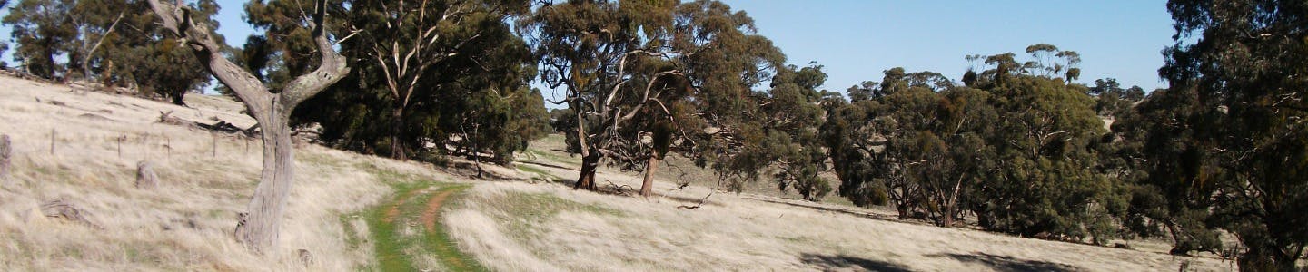
Have your say on the establishment of greenways to secure the Heysen and Mawson trail networks within Wirrabara and Bundaleer Forests.
What is being decided?
The State Government has been conducting the Mid North Forests Future Strategy to determine the future for Bundaleer, Wirrabara, Leighton and Yarcowie Forest Reserves since theContinue reading
About
This engagement has now closed.
Following completion of the survey, by Governor’s Proclamation of 30 January 2018 four greenways have now been created in the Wirrabara and Bundaleer Forests. You can view the Gazette notice here. See Updates for more information.
Updates and outcomes | What you said |
Have your say on the establishment of greenways to secure the Heysen and Mawson trail networks within Wirrabara and Bundaleer Forests.
What is being decided?
The State Government has been conducting the Mid North Forests Future Strategy to determine the future for Bundaleer, Wirrabara, Leighton and Yarcowie Forest Reserves since the devastating bushfires of 2013 and 2014. Led by Primary Industries and Regions SA (PIRSA), the Strategy is nearing its conclusion.
As this process ends, ownership and management of Bundaleer and Wirrabara Forests may soon change.
The Strategy has involved extensive community consultation, including public meetings. This engagement identified, among other things, concerns within the community over the future of access to trails in the Wirrabara and Bundaleer Forests and the associated implications of closure to the public of associated historic and community facilities.
To address community concerns, and ensure the significant recreational trails which pass through these iconic forests continue to be protected and enjoyed, the State Government is proposing to use provisions under the Recreational Greenways Act 2000 to create a greenway over sections of the Heysen and Mawson Trails within Wirrabara and Bundaleer Forests that are proposed to be sold to private parties. These are referred to as the Bundaleer Greenway and the Wirrabara Greenway.
Using these provisions will enable the State Government to protect the Heysen and Mawson Trail networks for recreational access in perpetuity for use by walkers and/or cyclists.
It is proposed these trails may be re-routed to incorporate some of the other, smaller trails and their associated assets within the forests, to protect a greater trail network under the greenway. Maps are available on this webpage for both forests, showing both the existing Heysen and Mawson Trails and the proposed Bundaleer and Wirrabara greenways.
Before doing so, we are seeking your feedback on the proposed greenways by COB Monday 12 June 2017.
How will your input be used?
A public consultation is being led by the Office for Recreation and Sport, in collaboration with PIRSA and DEWNR, around the proposal to create a greenway over the Heysen and Mawson Trail within the Wirrabara and Bundaleer Forests.
In particular, the wider community and adjoining landowners are being asked for feedback on:
- using a greenway to protect access to significant trails and associated trail infrastructure
- the proposed Bundaleer and Wirrabara greenways
- any other issues, ideas or observations.
Your comments and the feedback provided through YourSAy will inform the Government’s final decision on the proposal to create the Bundaleer and Wirrabara greenways over the Heysen and Mawson Trail alignments within the Wirrabara and Bundaleer Forests.
Get involved
Submit your feedback in the online discussion.
Otherwise, any feedback with the proposed use of greenways through Bundaleer and Wirrabara Forests can be forwarded by:
- emailing to DPTI.CommunityRelations@sa.gov.au
- mailing to GPO Box 1533, Adelaide SA 5001
Any queries or concerns related to the Mid North Forests Future Strategy, as opposed to the Greenways, should be directed to pirsa.forestry@sa.gov.au.
Want to know more?
Contact the project team via the DPTI Community Relations team – e-mail DPTI.CommunityRelations@sa.gov.au, or phone 1300 794 880.
-
Proposed Bundaleer Greenway
Share on Facebook Share on Twitter Share on Linkedin Email this linkThe Heysen and Mawson Trails were established in the Bundaleer Forest in the late 1980s/early 1990s. Trail infrastructure also includes the Curnow’s Hut which is used for overnight accommodation and camping by trails users. The Heysen Trail is managed by DEWNR with support from the Friends of the Heysen Trail and Other Walking Trails and the Mawson Trail is managed by DPTI/Office for Recreation and Sport.
As part of the Mid North Forests Future Strategy a process has been initiated to protect the Heysen and Mawson Trails and related infrastructure under the Recreational Greenways Act 2000.
It is proposed that the Heysen and/or Mawson Trails be realigned to form the Bundaleer Greenway to include sections of the existing forest trails, heritage buildings and sites, accommodation and camping sites and community art.
We acknowledge the significant amount of feedback that we have received from the community in relation to the Bundaleer picnic grounds and surrounding trails.
Please be assured that the key issues that have been raised on these pages in relation to the Bundaleer picnic grounds, trails beyond the existing Mawson and Heysen trails (in both forests) and issues relating to Greenways and Public Liability Insurance are acknowledged. They have been noted and will be considered by the project team upon the consultation period closing on Monday 12 June 2017.
Proposed Bundaleer Forest Greenway:
Located in the Bundaleer Forest, Hundreds of Belalie and Yangya, South Australia, the proposed greenway comprises three portions as described below:
PORTION A: Commencing at the intersection of Springs Road, Bundaleer Gardens and the Heysen Trail, thence following internal forest trails generally westerly to Curnows Hut, thence generally northerly, westerly, northerly and easterly to Neindorf Road, Bundaleer Gardens.
PORTION B: Commencing at the Bundaleer Picnic Ground, Bundaleer North, thence following internal forest trails generally northerly and westerly to Conservators Hut, thence generally westerly, northerly, westerly and southerly to the intersection of Brown Track and Bore Track, Bundaleer North.
PORTION C: Commencing at the Bundaleer Picnic Ground, Bundaleer North, thence following internal forest trails generally northerly, westerly northerly and westerly to Range Road, Bundaleer North in the vicinity of the Bundaleer Golf Course.
Uses: The intended public use of the proposed Bundaleer Forest Greenway portions A & B above will be limited to recreational walking only and the intended public use of the proposed Bundaleer Forest Greenway portion C above will be limited to recreational walking and cycling only.
Maps: Click here to see maps describing the proclaimed Greenways routes.
The proposed Bundaleer Greenway portions A and B (which encompasses sections of the Heysen Trail) would include the following features::
- Curnow’s Hut
- A new section of trail linking Curnow’s Hut and the Bundaleer Picnic Ground using existing fire tracks
- Bundaleer Picnic Ground
- A section of the Sculpture Trail
- Foresters House Ruin
- A section of the Scenic Trail
- The Old Forest Office (State Heritage Listed Building)
- The section of the Conservator's Trail between the Picnic Ground and the Conservator's Hut
- The Seeds Beds (State Heritage listed site)
- Conservator's Hut
- The eastern and northern section of the Conservator's Trail including the lookout
- The Bundaleer Arboretum
- A new section of trail using existing firebreaks between the arboretum and New Campbell Hill.
The proposed Bundaleer Greenway Portion C (which encompasses sections of the Mawson Trail) located in the northern part of the forest, also requires protection and this greenway is proposed to include the southern section of the Conservator’s Trail, which would give cyclists access to Conservator’s Hut and effectively retain all of the current access to the trail, known as the Conservator’s Trail.
Proposed Bundaleer Greenway
Heysen Trail
Summary Description
From Curnow’s Hut the trail heads in a northerly direction and follows a series of named and unnamed fire tracks, two short sections of fence line and a section of the Maple Walk until it reaches the Bundaleer Picnic Ground. From the Bundaleer Picnic Ground it follows the Sculpture Trail and a section of the Conservator’s Trail, past the Conservator’s Hut and onto a section of the Conservator’s Track until it meets Neindorf Road where it connects onto the current alignment of the Mawson Trail. It then follows the Mawson Trail to the Booyoolie Track. It then follows sections of the Booyoolie, Johnston and Brown Tracks until it exits the forest on the western boundary.
Detailed Description
PORTION A
From the vicinity of Never Never Creek and Springs Road, the Heysen Trail heads towards Curnow’s Hut. It then follows unnamed fire tracks in a northerly direction to the junction of Bore Track. It then follows Bore Track to the west and then turns north along Orchard Track. It follows Orchard Track for a short distance then turns west and follows unnamed fire tracks around the edge of pine and sugar gum plantations. It then crosses over a fence and runs along the boundary of a PIRSA – Farm Forestry Demonstration Site (Mixed Eucalypt Seed Orchard) until it joins with Catalpa Track. It then follows downhill in a north easterly direction where it turns to the east and follows a fence line for a short distance until it meets Neindorf Road.
PORTION B
From the Bundaleer Picnic ground the trail follows the Conservator’s Trail past Bundaleer Cottage and seed beds (State Heritage Listed) to Conservator’s Hut.
From Conservator’s Hut the trail follows an unnamed track to the scenic lookout which features a stone wall and community art installation made from recycled fencing wire. The trail then follows the north edge of the Conservator’s Trail until it meets the Conservator’s Track. It crosses a fence then heads in a westerly direction for a short distance until it meets the Mawson Trail. It then follows the route of the Mawson Trail in a north easterly direction until it meets Booyoolie Track. The trail crosses a fence then heads in a north westerly direction uphill on a fairly undefined track until it meets Johnston Track were excellent views to the north and west can be seen. The trail heads south along Johnston Track until it meets Neindorf Road. It crosses Neindorf Road and a fence and re-enters the forest. The trail follows Brown Track through a plantation of very old pine and then follows a ridge track which passes through and adjacent to an old stone wall with excellent views in all directions until it meets the existing Heysen Trail and exits the forest and heads west to Georgetown.
Mawson Trail
Summary Description
From the junction of the Bundaleer Picnic Ground and Springs Road it follows sections of the Conservator’s Trail, past Conservator’s Hut and onto a section of the Conservator’s Track until it meets Neindorf Road where it connects back onto the current alignment of the Mawson Trail.
Detailed Description
PORTION C
From the junction of the Bundaleer Picnic Ground and Springs Road it follows sections of the Conservator’s Trail. The trail follows the southern edge of the Conservator’s Trail along the Conservator’s Track past the Bundaleer Arboretum until it meets Neindorf Road and then follows the current alignment of the Mawson Trail in a northerly direction.
-
Proposed Wirrabara Greenway
Share on Facebook Share on Twitter Share on Linkedin Email this linkThe Wirrabara Forest Reserve was established in 1877 and was one of the state’s first forest reserves. It is located in the Southern Flinders Ranges approximately 8km west of the township of Wirrabara and covers an area of 7,000 hectares including 4,150 hectares of native vegetation which is protected for conservation. The Wirrabara Forest Reserve was modelled as a community forest. It was historically managed for sustainable commercial forestry, while providing for the conservation of native flora and fauna and community use for recreation.
The Heysen and Mawson Trails both pass through parts of the forest. The Heysen Trail is managed by DEWNR with support from the Friends of the Heysen and Other Walking Trails and the Mawson Trail managed by DPTI/Office for Recreation and Sport.
Proposed Wirrabara Forest Greenway:
Located in the Wirrabara Forest, Hundred of Darling, South Australia, the proposed greenway comprises two portions as described below:
PORTION A: Commencing at the Ippinitchie Campground, Wirrabara, thence generally in a south westerly direction north of and parallel to Forest Road, Wirrabara to the vicinity of the Wirrabara Picnic Ground, thence general westerly along the alignment of Ippinitchie Creek to the vicinity of the Wirrabara Forest Nursery, thence northerly and westerly to the north western corner of Section 54, Hundred of Darling.
PORTION B: Commencing at White Park Hut, White Park Road, Wirrabara thence generally in north westerly direction south of and parallel to White Park Road, then, south westerly and southerly along existing forest tracks to the southern boundary of Section 39 Hundred of Darling, then easterly to Block 9 Road and then generally southerly along the western boundary of Section 9 Hundred of Darling to the point where Section 9 Hundred of Darling directly abuts Section 10 Hundred of Darling.
Uses: The intended public use of the proposed Wirrabara Forest Greenway portions A & B above will be limited to recreational walking only.
Maps: Click here to see maps describing the proclaimed Greenways routes.
Proposed Wirrabara Greenway
The current alignment of the Mawson Trail follows roads which are external to the forest and therefore no action is required to ensure their protection.
Heysen Trail
PORTION A
It is proposed that a Greenway be established over the section of the Forest Circuit trail, between the Wirrabara Range through to the Old Wirrabara Nursery and to the Ippinitchie Campground and that it be remarked as a Heysen Trail alternative route to secure access for trail users from the main trail to the Ippinitchie Campground.
PORTION B
A Greenway is required over the current route of the Heysen Trail in the northern part of the forest between Rocky Ridge Track and White Park Road as this section of trail is located in general forestry plantation areas and may not be retained in Government ownership.
-
Further information
Share on Facebook Share on Twitter Share on Linkedin Email this linkWhat is the Recreational Greenways Act 2000?
The Recreational Greenways Act 2000 was established to secure public access over corridors of land that form part of a recreational trail. It allows for the State Government to enter into an agreement with any private or public landowner to protect or create a greenway for public use.
The proposed greenways will ensure ongoing public access to the state’s premier long distance walking and cycling trails, the Heysen and Mawson Trail networks in Wirrabara and Bundaleer Forests, by proclaiming greenways as such under the Act.
If this land is then sold, the Act contemplates the Minister for Recreation and Sport entering into land access agreements with current owners and noting the agreement on the relevant titles. The Act further provides that access agreements would, having been noted on the title, be attached to the land and ensure continued public access to the greenways for their respective recreational use: Heysen Trail - walking, the Mawson Trail - cycling and walking.
Aside from trails, the Act can also provide for the protection and preservation of buildings, structures, signs and other improvements on greenways.
What areas will be impacted?
The trails to be affected are entirely contained within the respective boundaries of Bundaleer and Wirrabara Forest Reserves. A map of the proposed greenways is available on this webpage, at the Bundaleer and Wirrabara pages.
The proposed greenways are focussed on the Heysen and Mawson Trail networks. These trails allow for recreational access for hikers/walkers and cyclists respectively, and pass through both Bundaleer and Wirrabara forests.
The proposed Wirrabara greenway will be used to protect access to trails in areas that may be under private ownership in the future. This would be a small length of trail in the north and a small length travelling east from the Wirrabara Range to the Ippinitchie Camp Ground. The existing trail through the Wirrabara Range will be accessible for public use as it has been historically.
In Bundaleer Forest a new route is proposed for the Bundaleer greenway. This would give trail users access to accommodation and camping areas such as Conservator’s and Curnow’s Huts. To protect the smaller trails of the network, and create a more intuitive and connected user experience, the proposed greenways include re-routes of the Mawson and Heysen Trails.
-
Updates
Share on Facebook Share on Twitter Share on Linkedin Email this linkGreenways Consultation Update
The project team received a wealth of information from the community through this consultation process regarding the use of the Recreational Greenways Act 2000 to preserve the alignments of the Mawson and Heysen Trail through the Bundaleer and Wirrabara forests.
In summary, the project team received 306 submissions to the YourSAy page and 44 emails, with a smaller number of letters and phone calls, through the consultation period. We thank everybody who has taken the time to provide us with their thoughts.
The overwhelming majority of feedback (around 80%) related to the preservation of public access to community recreational areas and facilities, particularly at Bundaleer. However, the consultation also provided important consideration points in relation to other factors as well, such as proposed trail/greenway alignments, designated Greenway use and impact on local business, to name a few.
The project team is now defining a program for further targeted consultation.
Make use of the ‘Stay Informed’ service on www.yoursay.sa.gov.au/greenways to be notified of further updates.
Once again, thank you for contributing to the process to date.
-
Updates
Share on Facebook Share on Twitter Share on Linkedin Email this linkGreenways Consultation - closed
Following completion of the survey, by Governor’s Proclamation of 30 January 2018 four greenways have now been created in the Wirrabara and Bundaleer Forests. You can view the Gazette notice here. Click here to see maps describing the proclaimed Greenways routes.
Status
-
CLOSED
Greenways is currently at this stageThis consultation closed on 12 February 2018.
Documents

Key Dates
-
12 June 2017
